Please use this identifier to cite or link to this item:
https://doi.org/10.21256/zhaw-28254Full metadata record
| DC Field | Value | Language |
|---|---|---|
| dc.contributor.author | Laube, Patrick | - |
| dc.contributor.author | Ratnaweera, Nils | - |
| dc.contributor.author | Wróbel, Anna | - |
| dc.contributor.author | Kaelin, Ivo | - |
| dc.contributor.author | Stephani, Annette | - |
| dc.contributor.author | Reifler-Baechtiger, Martina | - |
| dc.contributor.author | Graf, Roland F. | - |
| dc.contributor.author | Suter, Stefan | - |
| dc.date.accessioned | 2023-07-13T11:50:17Z | - |
| dc.date.available | 2023-07-13T11:50:17Z | - |
| dc.date.issued | 2023 | - |
| dc.identifier.issn | 0921-2973 | de_CH |
| dc.identifier.issn | 1572-9761 | de_CH |
| dc.identifier.uri | https://digitalcollection.zhaw.ch/handle/11475/28254 | - |
| dc.description | Erworben im Rahmen der Schweizer Nationallizenzen (http://www.nationallizenzen.ch) | de_CH |
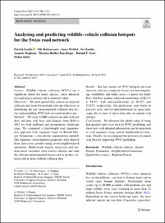
| dc.description.abstract | Context: Wildlife–vehicle collisions (WVCs) are a significant threat for many species, cause financial loss and pose a serious risk to motorist safety. Objectives: We used spatial data science on regional collision data from Switzerland with the objectives of identifying the key environmental collision risk factors and modelling WVC risk on a nationwide scale. Methods: We used 43,000 collision records with roe deer, red deer, wild boar, and chamois from 2010 to 2015 for both midlands and mountainous landscape types. We compared a fixed-length road segmentation approach with segments based on Kernel Density Estimation, a data-driven segmentation method. The segments’ environmental properties were derived from land-cover geodata using novel neighbourhood operations. Multivariate logistic regression and random forest classifiers were used to identify and rank the relevant environmental factors and to predict collision risk in areas without collision data. Results: The key factors for WVC hotspots are road sinuosity, and two composite factors for browsing/forage availability and traffic noise—a proxy for traffic flow. Our best models achieved sensitivities of 82.5% to 88.6%, with misclassifications of 20.14% and 27.03%, respectively. Our predictions were better in forested areas and revealed limitations in open landscape due to lack of up-to-date data on annual crop changes. Conclusions: We illustrate the added value of using fine-grained land-cover data for WVC modelling, and show how such detailed information can be annotated to road segments using spatial neighbourhood functions. Finally, we recommend the inclusion of annual crop data for improving WVC modelling. | de_CH |
| dc.language.iso | en | de_CH |
| dc.publisher | Springer | de_CH |
| dc.relation.ispartof | Landscape Ecology | de_CH |
| dc.rights | http://creativecommons.org/licenses/by/4.0/ | de_CH |
| dc.subject | Wildlife–vehicle collision | de_CH |
| dc.subject | Kernel Density Estimation | de_CH |
| dc.subject | Neighbourhood function | de_CH |
| dc.subject | Spatial data science | de_CH |
| dc.subject | Random forest | de_CH |
| dc.subject.ddc | 333: Bodenwirtschaft und Ressourcen | de_CH |
| dc.subject.ddc | 380: Verkehr | de_CH |
| dc.title | Analysing and predicting wildlife–vehicle collision hotspots for the Swiss road network | de_CH |
| dc.type | Beitrag in wissenschaftlicher Zeitschrift | de_CH |
| dcterms.type | Text | de_CH |
| zhaw.departement | Life Sciences und Facility Management | de_CH |
| zhaw.organisationalunit | Institut für Computational Life Sciences (ICLS) | de_CH |
| zhaw.organisationalunit | Institut für Umwelt und Natürliche Ressourcen (IUNR) | de_CH |
| dc.identifier.doi | 10.1007/s10980-023-01655-5 | de_CH |
| dc.identifier.doi | 10.21256/zhaw-28254 | - |
| zhaw.funding.eu | No | de_CH |
| zhaw.issue | 7 | de_CH |
| zhaw.originated.zhaw | Yes | de_CH |
| zhaw.pages.end | 1783 | de_CH |
| zhaw.pages.start | 1765 | de_CH |
| zhaw.publication.status | publishedVersion | de_CH |
| zhaw.volume | 38 | de_CH |
| zhaw.publication.review | Peer review (Publikation) | de_CH |
| zhaw.webfeed | Bio-Inspired Methods & Neuromorphic Computing | de_CH |
| zhaw.webfeed | Datalab | de_CH |
| zhaw.webfeed | Geoinformatik | de_CH |
| zhaw.webfeed | Wildtiermanagement | de_CH |
| zhaw.funding.zhaw | Prävention von Wildtierunfällen auf Verkehrsinfrastrukturen | de_CH |
| zhaw.author.additional | No | de_CH |
| zhaw.display.portrait | Yes | de_CH |
| Appears in collections: | Publikationen Life Sciences und Facility Management | |
Files in This Item:
| File | Description | Size | Format | |
|---|---|---|---|---|
| 2023_Laube-etal_Analysing-and-predicting-wildlife-vehicle-collision-hotspots.pdf | 1.37 MB | Adobe PDF |  View/Open |
Show simple item record
Laube, P., Ratnaweera, N., Wróbel, A., Kaelin, I., Stephani, A., Reifler-Baechtiger, M., Graf, R. F., & Suter, S. (2023). Analysing and predicting wildlife–vehicle collision hotspots for the Swiss road network. Landscape Ecology, 38(7), 1765–1783. https://doi.org/10.1007/s10980-023-01655-5
Laube, P. et al. (2023) ‘Analysing and predicting wildlife–vehicle collision hotspots for the Swiss road network’, Landscape Ecology, 38(7), pp. 1765–1783. Available at: https://doi.org/10.1007/s10980-023-01655-5.
P. Laube et al., “Analysing and predicting wildlife–vehicle collision hotspots for the Swiss road network,” Landscape Ecology, vol. 38, no. 7, pp. 1765–1783, 2023, doi: 10.1007/s10980-023-01655-5.
LAUBE, Patrick, Nils RATNAWEERA, Anna WRÓBEL, Ivo KAELIN, Annette STEPHANI, Martina REIFLER-BAECHTIGER, Roland F. GRAF und Stefan SUTER, 2023. Analysing and predicting wildlife–vehicle collision hotspots for the Swiss road network. Landscape Ecology. 2023. Bd. 38, Nr. 7, S. 1765–1783. DOI 10.1007/s10980-023-01655-5
Laube, Patrick, Nils Ratnaweera, Anna Wróbel, Ivo Kaelin, Annette Stephani, Martina Reifler-Baechtiger, Roland F. Graf, and Stefan Suter. 2023. “Analysing and Predicting Wildlife–Vehicle Collision Hotspots for the Swiss Road Network.” Landscape Ecology 38 (7): 1765–83. https://doi.org/10.1007/s10980-023-01655-5.
Laube, Patrick, et al. “Analysing and Predicting Wildlife–Vehicle Collision Hotspots for the Swiss Road Network.” Landscape Ecology, vol. 38, no. 7, 2023, pp. 1765–83, https://doi.org/10.1007/s10980-023-01655-5.
Items in DSpace are protected by copyright, with all rights reserved, unless otherwise indicated.